Walk: Thirsty Hinterlands (Marseille)
What Marseille gains in strength through its opening towards the sea and its defensive arc of rocky massifs, it loses in connection to the land, to its fertile plains and rivers.
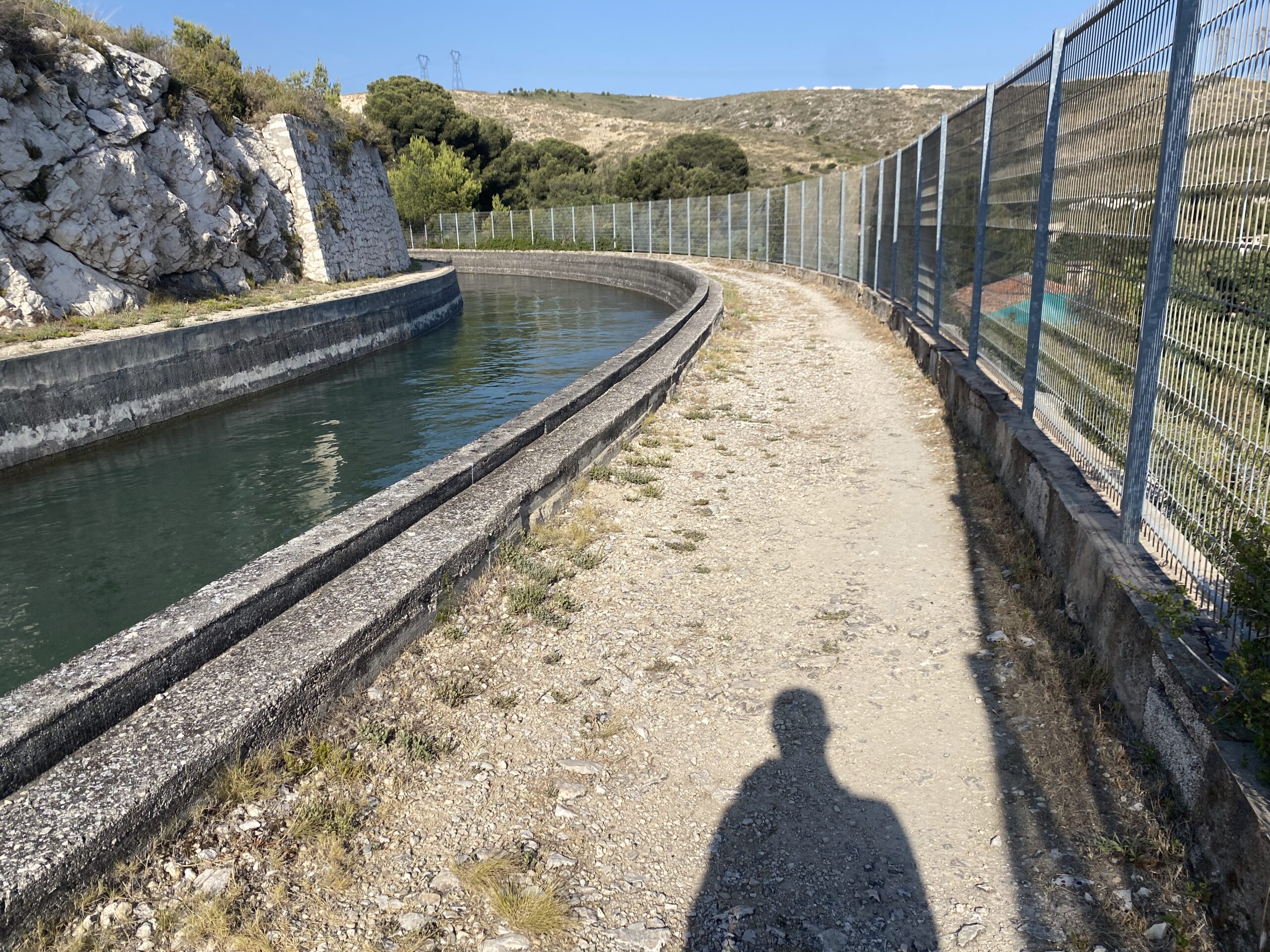
Following an era of drought, disease, and accompanying social unrest in the ‘Phocean city’, the Canal de Marseille was built in stages between 1838 and 1881, channeling water from the Durance river further north to irrigate and hydrate Marseille and its region, via 200 kilometres of tunnel and aqueduct. Transforming the city’s typically rocky Mediterranean hinterland into fertile agricultural terrain, it tripled the city’s inhabitants and until the 1970s remained one of its few sources of drinking water.
Known by its landmarks (the Pavillon de partage des eaux des Chutes-Lavie; the Palais Longchamp; or the Aqueduc de Roquefavour) the majority of the canal itself is hidden underground or (formally) inaccessible behind barriers, even though it still provides nearly two thirds of Marseille’s water.
This walk follows a section of the canal that runs along the land-facing edge of the Quartiers Nords, Marseille’s mythical zone onto which are projected wider society’s Gomorra-like imaginaries and nightmares, a territory long abandoned by the state and wider societal perception as a no-go zone of gangs and mafia.
Indeed, Marseille’s social landscape is influenced by connections to Neapolitan and Genovese mafia and its physical landscape carries the scars of decades of corruption connected to the infiltration of these into the state at various levels. But the reality of the Quartiers Nords is much more complex. They are a very heterogeneous collection of Mediterranean typologies – Provençal hilltop villages (noyaux villageois) and walled farms (bastides) – as well as more general phenomena of European cities – social housing estates (cités), single family homes (zones pavillonnaires), undefined terrains (terrains vagues), allotments (jardins ouvriers), and new property developments. These typologies are organised, and (dis)connected from one another, by well an uneven terrain of valleys and steep slopes, traversed by infrastructures of transport, industry, and ecology. For France, this makes for a uniquely Mediterranean texture, all of which you can see from the train window.
Because the Quartiers Nord are defined both by their connection to and segregation from the sea, both by the infrastructures of marine economies and trade. Throughout our walk the sea will accompany us, seeming just within reach. But, from the Vieux Port until l’Estaque, yet further north of here, it is impossible to swim. As Marseille legend goes, many children in these areas reach their teenage years without ever accessing it. I’m no expert on the sociology of the Quartiers Nords, but I would guess the truth of this is as heterogeneous as the landscape. Nonetheless, it is a landscape full of intriguing contradictions: naturally dry yet fertile; coastal yet facing the land; open but full of barriers; traversed by water that is hidden.
What do public life, civic space, and bodily relationship to landscape and ecology mean amongst this fragmentation?
Listening Score
What is being asked of you in this space?
What is being denied to you?
Are you encroaching or are you invited?
How is the soundscape staging your voice – so that you whisper, or converse, or stay quiet?
How do the things you hear relate to each other and your body? Are they in some way supports or byproducts of your presence? Do they create or take up acoustic space?
How do sounds shape each other – through response, counterpoint, or muffling?
Can you feel the canal calling as we gravitate towards it whilst mostly failing to reach it, this hydrobody that hydrates tens of thousands of human bodies below. Where and how does it become audible? How else does it find a voice?
How about the sea?
Images